

File:SHR Level two map labelled.png
Wikisimpsons - The Simpsons Wiki
Size of this preview: 800 × 573 pixels. Other resolutions: 1,024 × 734 pixels | 1,234 × 884 pixels.
Original file (1,234 × 884 pixels, file size: 52 KB, MIME type: image/png)
Summary
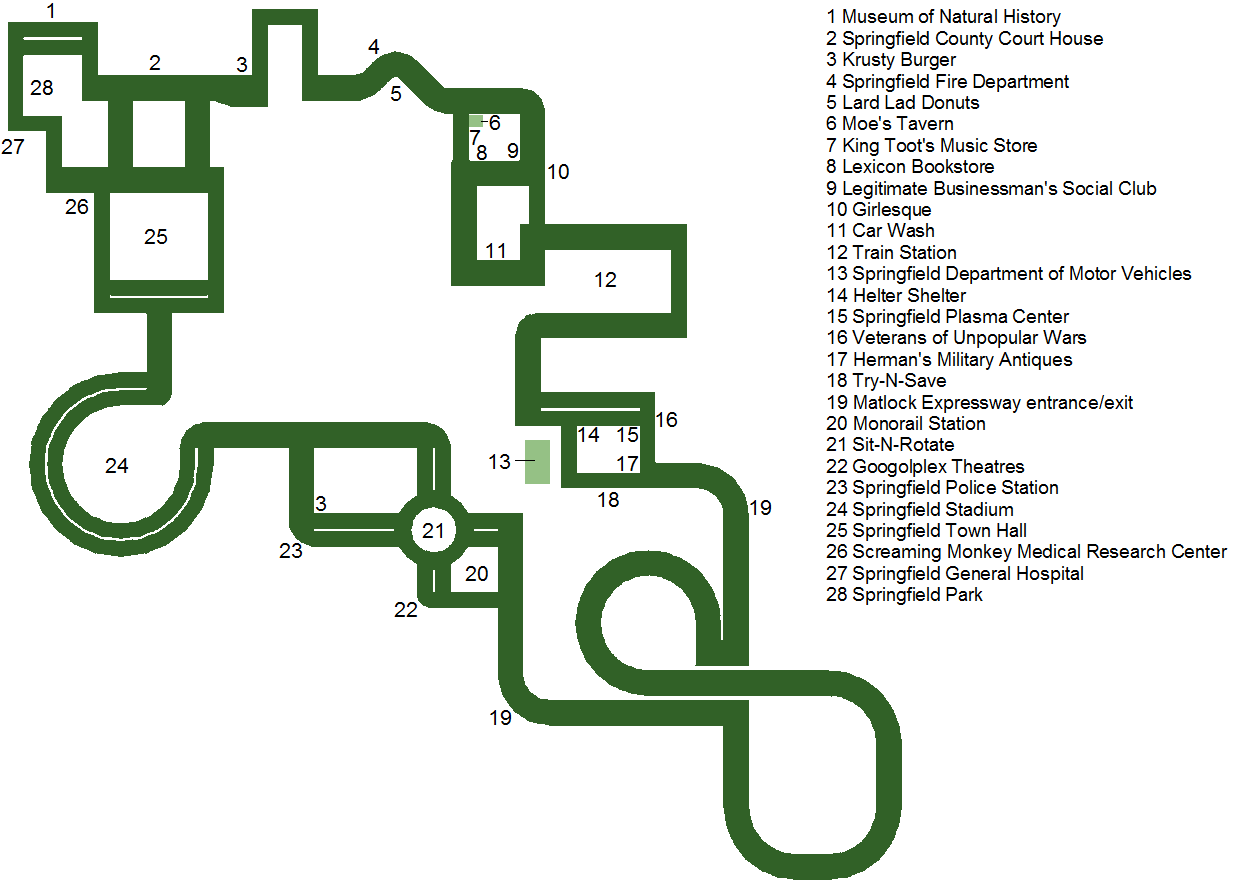
Map of part of Springfield used in levels two and five of The Simpsons: Hit & Run. Edited to include labels for key locations.
Licensing

|
This file is an image from The Simpsons video game The Simpsons: Hit & Run. Its use is believed to qualify as fair use under United States copyright law. |
File history
Click on a date/time to view the file as it appeared at that time.
| Date/Time | Thumbnail | Dimensions | User | Comment | |
|---|---|---|---|---|---|
| current | 10:03, March 9, 2016 | | 1,234 × 884 (52 KB) | Zenthor (talk | contribs) | Map of part of Springfield used in levels two and five of ''The Simpsons: Hit & Run'' (labelled). |
- You cannot overwrite this file.
File usage
The following 4 pages link to this file: